


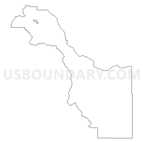
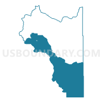
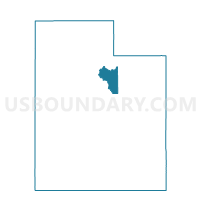
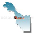
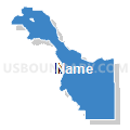
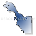
Wasatch County - South Voting District, Wasatch County, Utah
About
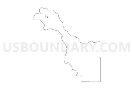
Outline
Summary
| Unique Area Identifier | 680374 |
| Name | Wasatch County - South Voting District |
| County | Wasatch County |
| State | Utah |
| Area (square miles) | 464.97 |
| Land Area (square miles) | 443.93 |
| Water Area (square miles) | 21.04 |
| % of Land Area | 95.47 |
| % of Water Area | 4.53 |
| Latitude of the Internal Point | 40.17199010 |
| Longtitude of the Internal Point | -111.10559430 |
Maps

Graphs
Select a template below for downloading or customizing gragh for Wasatch County - South Voting District, Wasatch County, Utah


Neighbors
Neighoring Voting District (by Name) Neighboring Voting District on the Map
- Birdseye - Covered Bridge Voting District, Utah County, UT
- Charleston Town Voting District, Wasatch County, UT
- Fruitland Voting District, Duchesne County, UT
- Provo Canyon Voting District, Utah County, UT
- Springville 7 Voting District, Utah County, UT
- Wallsburg Town Voting District, Wasatch County, UT
- Wasatch County - Center Creek Voting District, Wasatch County, UT
- Wasatch County - East Voting District, Wasatch County, UT
- Wasatch County - Southfields Voting District, Wasatch County, UT
- Wasatch County - West Voting District, Wasatch County, UT
Top 10 Neighboring County Subdivision (by Population) Neighboring County Subdivision on the Map
- American Fork-Pleasant Grove CCD, Utah County, UT (121,452)
- Springville-Mapleton CCD, Utah County, UT (42,473)
- Heber City East CCD, Wasatch County, UT (9,965)
- Heber City West CCD, Wasatch County, UT (8,133)
- Duchesne CCD, Duchesne County, UT (3,839)
- Heber City South CCD, Wasatch County, UT (3,335)
- Uintah and Ouray CCD, Wasatch County, UT (11)
- Soldier Summit CCD, Wasatch County, UT (0)
Top 10 Neighboring Place (by Population) Neighboring Place on the Map
Top 10 Neighboring Unified School District (by Population) Neighboring Unified School District on the Map
- Alpine School District, UT (284,505)
- Nebo School District, UT (119,571)
- Wasatch School District, UT (23,530)
- Duchesne School District, UT (18,607)
Top 10 Neighboring State Legislative District Lower Chamber (by Population) Neighboring State Legislative District Lower Chamber on the Map
- State House District 65, UT (49,224)
- State House District 67, UT (42,669)
- State House District 54, UT (42,563)
- State House District 62, UT (32,162)
Top 10 Neighboring State Legislative District Upper Chamber (by Population) Neighboring State Legislative District Upper Chamber on the Map
- State Senate District 13, UT (150,707)
- State Senate District 26, UT (101,392)
- State Senate District 27, UT (93,972)
- State Senate District 16, UT (82,618)
Top 10 Neighboring 111th Congressional District (by Population) Neighboring 111th Congressional District on the Map
Top 10 Neighboring Census Tract (by Population) Neighboring Census Tract on the Map
- Census Tract 9405, Wasatch County, UT (8,614)
- Census Tract 9604, Wasatch County, UT (5,092)
- Census Tract 9403, Duchesne County, UT (3,847)
- Census Tract 109, Utah County, UT (1,059)
Top 10 Neighboring 5-Digit ZIP Code Tabulation Area (by Population) Neighboring 5-Digit ZIP Code Tabulation Area on the Map
- 84604, UT (49,145)
- 84032, UT (17,249)
- 84049, UT (4,372)
- 84526, UT (4,134)
- 84082, UT (743)
- 84027, UT (452)